QGIS Station Offset Tool - Introduction and Setup
Introduction and Setup
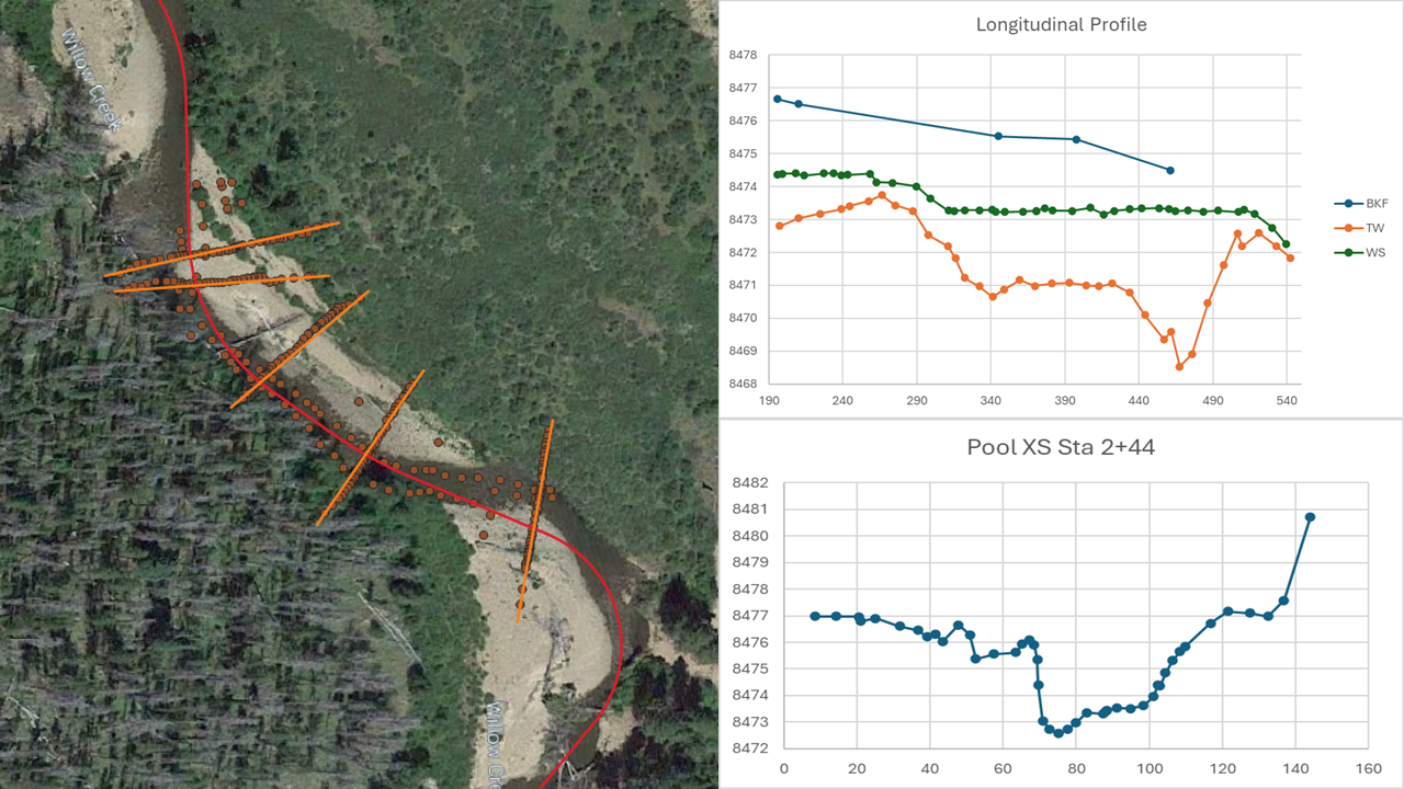
In this series we are going to use QGIS to process survey data, taking the survey data from 3-dimensions to 2-dimensions using the Station Offset Tool developed by Tailwater Limited. This allows you to see the data in two dimensions, station/elevation.
To get started you will need to have QGIS installed on your computer. QGIS is an open-source software available for free at www.qgis.org. I recommend downloading and installing the long-term release of QGIS.
The first video in the series will walk you through how to install two plugins. The first plugin is the QuickMapServices plugin that gives you access to aerial imagery. The second plugin is the Station Offset Tool.
The next video kicks off the using the Station Offset Tool and walks you through bringing your survey data into QGIS using the Station Offset Tool. To follow along with this video, you will need to download the "assessment.txt" file. This file is data that we collected on a creek in Colorado. The file is a text file that is in a PNEZD format, or Point Number, Northing, Easting, Elevation, Description.
The third video in the series will walk you through using the Station Offset Tool to project points to a shapefile. The shapefile we are using is available for download as a zip file, "clWillowCr.zip". You will need to unzip the file to bring the shapefile into QGIS.
The fourth video will show you how to create a shapefile representing the cross-sections that we will project to. The video also walks through using the Cross-Section Naming Tool. The tool will add the station that the cross-section intersects the centerline alignment to the attribute table, in the text field we created while creating the cross-section shapefile.
The fifth video we will using the Station Offset Tool to project the points to the cross-section lines.
The sixth video kicks of the data processing series, where we will walk through process the longitudinal profile data in excel.
The seventh and final video we will walk through processing the cross-section data in excel.
2 comments